Blasted Attractions
LEWIS & CLARK, Chapter 5:
IN WHICH THE SIGHTS MAKE HEADS TURN
space
Day 5: Rapid City, SD to Glendive, MT. On a very, very foggy morning we drove toward the Mount Rushmore National Memorial, wondering whether the Presidential quartet would be hidden in fog when we arrived. But by our arrival, the sky was a spectacular blue as we walked up the Avenue of Flags
(pictured above) at the entrance.
space
The Avenue of Flags was initially established as part of the celebration of the United States' Bicentennial in 1976 at the request of a visitor. The 56 flags represent the 50 states, one district, three territories, and two commonwealths of the United States of America.
spaspace ce
Mount Rushmore's carving was just as impressive as we have always heard— a tremendous engineering feat. At the museum, we learned that before tackling Rushmore, the sculptor, Gutzon Borglum, conceived the original concept and design for the Confederate memorial carving on Atlanta's Stone Mountain, beginning work in 1916.
Among his greatest challenges were how to position workers on the cliff and how to remove large amounts of granite. Borglum solved these problems by developing a sling chair to suspend workers from the mountain top and by using dynamite to remove stone. Although a disagreement with the Stone Mountain Commission ended his involvement with that project, both solutions were implemented and refined at Mount Rushmore.
space
With more than two million visitors annually, Mount Rushmore must be jammed at the height of the summer vacation season. The Rapid City area could hold its own with Chattanooga in terms of billboards advertising tourist attractions— reptile ranch, bear country, presidential alpine slide, and on and on. Water slides appear to be quite popular.
space
 |
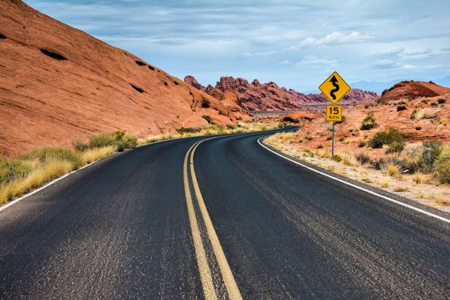
| Peter Norbeck Scenic Byway |
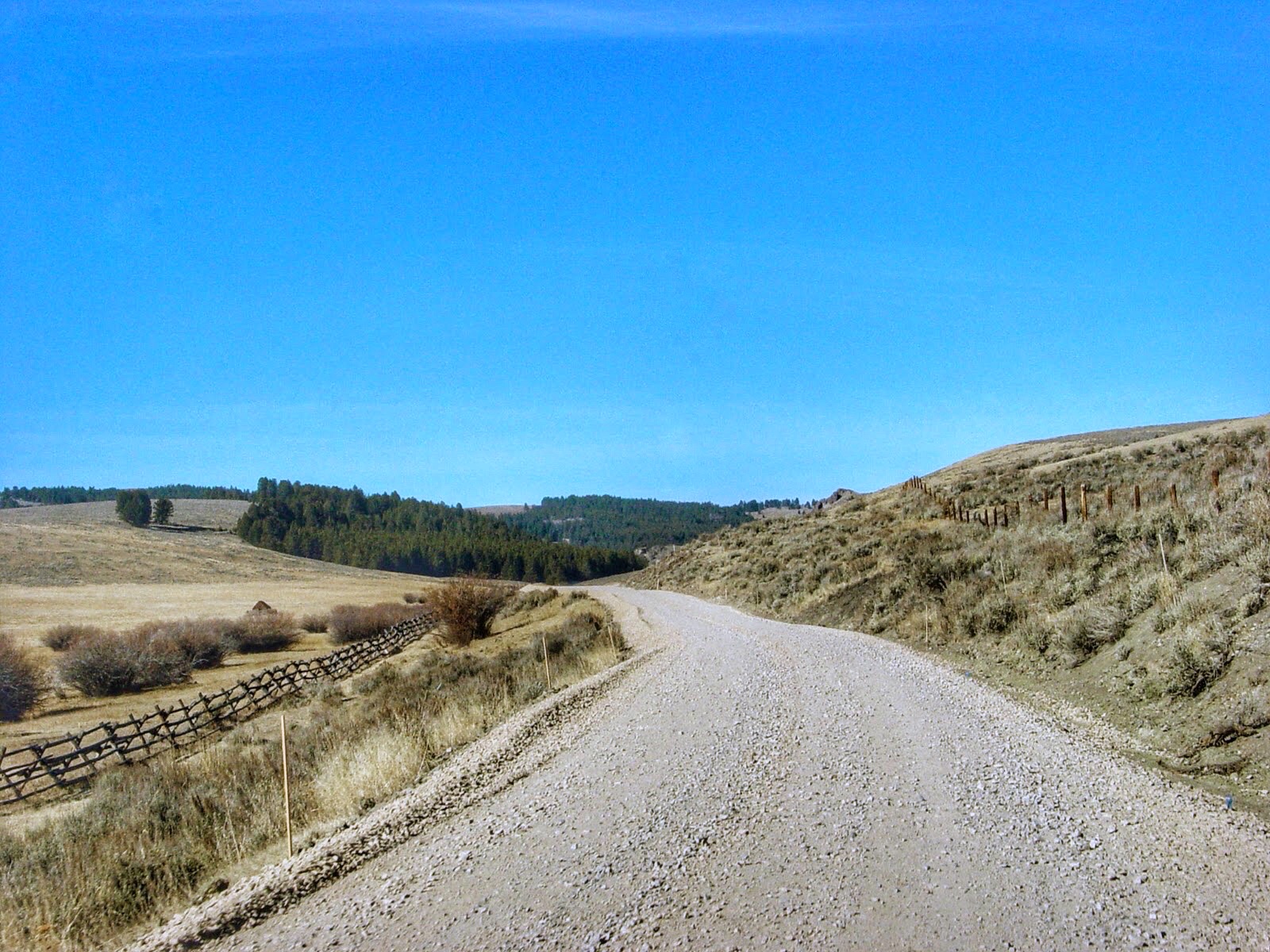
Leaving Rushmore, we traveled along the twisting Peter Norbeck Scenic Byway. With all its pigtail bridges, one-lane tunnels and hairpin turns, it took us 30 minutes to cover the ten miles to Custer State Park. Despite our hopes of seeing large numbers of buffalo in the park, we saw only a few in a corral and maybe a dozen others quite a distance from the road. The remainder of the 1,500-member herd seemed to be in hiding.
space
 |
| Mule deer at Custer State Park |
We did see lots of mule deer and white-tail deer, a few wild turkeys, and a very active prairie dog town. Two cats were in the horse stable area where we stopped for a picnic lunch. The younger one was very friendly, but the mother wouldn't approach us. Like so many other facilities we have encountered, the stables had closed for the season.
space
As we left Custer, we entered the heart of the Black Hills National Forest, winding back and forth, up and down through the evergreen-covered mountains. All the twisting and turning left both of us a little woozy by the time we wound our way through the corner of Wyoming and back into South Dakota at the towns of Lead and Deadwood.
space space .jpg) |
| Red Butte near Four Corners, Wyoming |
Along the way in Wyoming, we came across the beautiful Red Butte near the town of Four Corners. Its rusty color provided a nice contrast to the black hills of South Dakota.
space
From Deadwood we continued north on US-85. The landscape changed rather abruptly from towns built on the sides of mountains to an area of low grassy hills and hummocks and arrow straight roads. We checked the odometer at one point and determined that you could see a ten-mile stretch before the highway changed direction or elevation.
space 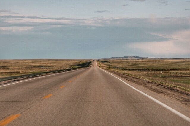 |
| The endless straight line that is US-85 |
Running along the side of the road were huge ranches. In addition to thousands of head of cattle, we also observed herds of deer grazing in the pastures. Several of these herds numbered in the 30s and one must have had 75. Snow had melted along this stretch with only an occasional patch dotting the tan landscape. We drove for very long distances without seeing anything but fences, cattle and deer—often not even any power lines or side roads. Trees and shrubs were nonexistent here. When we finally did pass a side road, it often had a sign with mileage to the local residents' houses—e.g., Sam Rogers, 26.8 miles; Bill Jones, 24.3 miles, etc.
space .jpg) |
| Security in Bowman, ND |
Towns were very few and far between, and the small towns we passed through seemed all but deserted late on this Friday evening. Population numbers on town signs indicated several hundred, but we weren't encountering any of them. When we stopped in Bowman, ND, to change drivers, we pulled into the parking lot of a general store. A vintage police car was parked nearby, and Ken was concerned when I turned the car around so that the headlights were shining directly into the police car. We thought it odd that the driver in his cowboy hat didn't turn his head until we realized it was a mannequin. On closer observation, we surmised that the car with its red bubble light on the roof probably hadn't even cranked for the last 20 or so years. Even Barney Fife wasn't that big a dummy!
space
By the time we were in North Dakota, night had fallen. Between the two small towns we passed through on an 80-mile stretch of US Highway 85, we drove through deep darkness. Other than stars and an occasional car, the darkness was rarely interrupted. A couple of times we saw lights a mile or two off the highway and guessed that a farmhouse might be there. Even after we got onto I-94, the exits we passed were much the same, some with "No Services" signs posted. Traffic was very light.
space
Finally about 9 p.m. we found a room for the night in Glendive, MT, the first town of any size along I-94 after entering the state. Exhausted, we made a quick sandwich and were soon in bed for the night.
space
Miles today: 487
States today: 4 (SD, WY, ND, MT)
space
FRIDAY, 25 OCTOBER 2002
 |
Where the buffalo roam
|
 |
| Norbeck Scenic Byway |


.jpg)
.jpg)

.jpg)


.jpg)

.jpg)


.jpg)

.jpg)
.jpg)

.jpg)
.jpg)
.jpg)


.jpg)

.jpg)