

Trail Town, USA
A HIGH COUNTRY HIGH, Day 4:
Damascus, VAAfter completing our jigsaw puzzle and saying goodbye to Ryan, who had to return home this morning, we left for our adventure to Damascus, VA (pop. 981), the self-proclaimed Trail Town, USA, and home of the annual Trail Days Festival, a celebration that attracts AT veterans and honors hikers as heroes. To reach this tiny village which hosts more than 20,000 festival goers each year, we had to cross the northeast corner of Tennessee.
space
On the way north, we stopped in Mountain City and located a letterbox that had been planted a couple of years ago but never found until today. As we crossed into Virginia on TN-91/VA-91, the road began to twist and turn, reminding us all too much of Friday's road to ruin Roan. But the town was only three miles north of the state line and soon we were headed for the Damascus Old Mill restaurant. Having read their menu and some excellent reviews on Yelp, we were looking forward to plenty of delectable vegetarian options.
What a surprise to learn that on Sundays, they serve a country cooking buffet at a city price— $14.95 for all you can eat of the fried chicken, vegetables laced with fatback pork, and other meat lover delights. And don't even think about ordering from the menu, not on Sunday. We're convinced they have a different cook for the buffet and give the regular chef Sundays off. With some Yelp help, we ended up at Quincy's Pizza, where we had an acceptable lunch, before going off to learn more about Trail Town, USA.
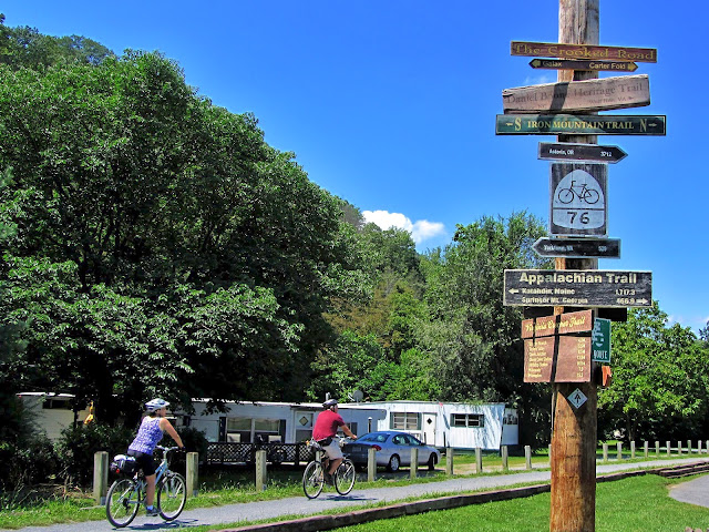
Among numerous others, four major scenic trails converge in the town—the Appalachian Trail, U.S. Bicycle Route 76, the Iron Mountain Trail, and the Virginia Creeper Trail. The streets and trails were handling some heavy bicycle traffic today. In the town park, we located the intersection of the AT and Virginia Creeper, a landmark in the clue for a letterbox we wanted to find.
space
What a surprise to learn that on Sundays, they serve a country cooking buffet at a city price— $14.95 for all you can eat of the fried chicken, vegetables laced with fatback pork, and other meat lover delights. And don't even think about ordering from the menu, not on Sunday. We're convinced they have a different cook for the buffet and give the regular chef Sundays off. With some Yelp help, we ended up at Quincy's Pizza, where we had an acceptable lunch, before going off to learn more about Trail Town, USA.
Among numerous others, four major scenic trails converge in the town—the Appalachian Trail, U.S. Bicycle Route 76, the Iron Mountain Trail, and the Virginia Creeper Trail. The streets and trails were handling some heavy bicycle traffic today. In the town park, we located the intersection of the AT and Virginia Creeper, a landmark in the clue for a letterbox we wanted to find.
space
 |
| Typical Virginia Creeper Trail trestle bridge |
In search of a letterbox, we headed a mile north of town to search another stretch of the Creeper. Though we didn't locate the box, Emma did make another new dog friend. Lucy, who was walking with her "aunt" cycling, seemed equally happy to make Emma's acquaintance.
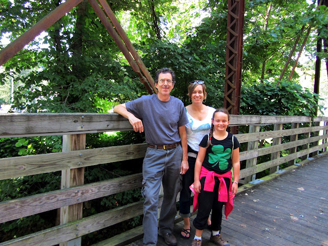
One of our primary reasons for this Virginia visit was locating a home for our Virginia letterbox, part of our plant-in-all-the-48-states project for 2012. After checking and rejecting a couple of locations in town, we finally settled on a spot off the AT just south of the Damascus city limits on VA-91.
space
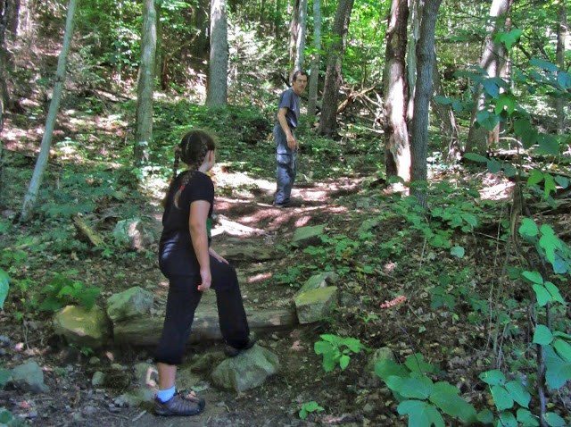 |
| On the AT near our new letterbox's home |
space
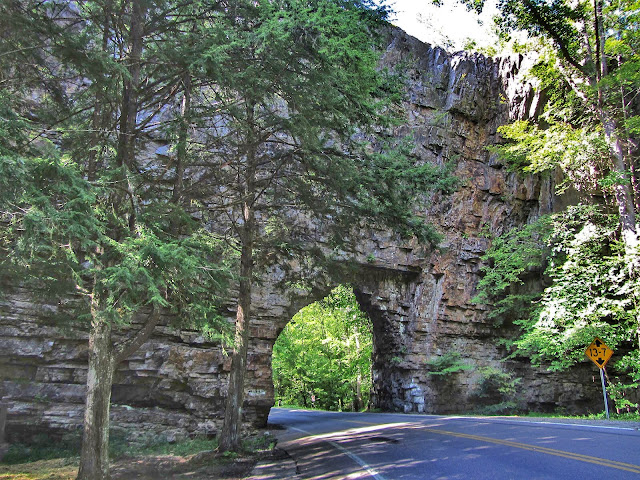 |
| Backbone Rock |
Little did we realize that our frolicking at Backbone Rock would come with a price. As we turned onto US-421 in Shady Valley to head back east to North Carolina, Marion suddenly recognized a venomous reptile—a stretch of road that motorcyclists love to call "The Snake." And if you guessed that this name comes from the pavement's tendency to twist and turn, you are correct. "Noooooo," we moaned, turning green just off the memory of Friday's trip to Roan. To encourage us that day, Marion had told us about a much worse road which she had ridden with friends several years ago. And now we were wrestling with that very road.
Fortunately Shady Valley is the midway point of this 33-mile stretch of road traversing 489 curves, three mountains, and one valley. Though we never realized before that he was a snake handler, Driver Ken was extremely kind and took this dizzying, stomach-churning roller coaster of a road very, very slowly, rarely getting above 20 mph. Needless to say, this speed was not to the liking of the motorcyclists who had come there specifically to experience the curves and bends, so we made good use of the many pull-offs to allow them to be on their speedy way.
Proud to say that we survived the snake without even turning the least bit green, we stopped at Harris Teeter before heading back to hearth and home. Since we arrived later than we expected, our plan to have leftovers seemed prescient. By 9:00, we were all ready to retire and recover from our reptile-wrangling experience.
space
SUNDAY, 12 AUGUST 2012
DAILY STATS
DAILY STATS
- Weather: sunny, 55° to 79°
- Letterboxes found: 4
- Bicyclists on trails in Damascus: 638
- Climbers at Backbone Rock: 35
- Snakes we wrestled: 1
 |
| Ken feeds water to an injured butterfly |
 |
| Emma on Virginia Creeper |
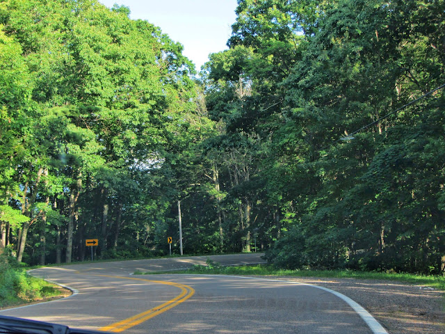 |
| US-421 snaking through eastern Tennessee |

