Rollin' on the River
LEWIS & CLARK, Chapter 2:
IN WHICH WE FIND THE MIGHTY MO
space
Day 2: Fairview Heights, IL to St. Joseph, MO. During the summer of 1803, Lewis oversaw the construction of a large keelboat, which he took down the Ohio River, picking up Clark and some recruits for the expedition party along the way. That fall, the expedition established a Camp Wood (also called Camp DuBois) on the east bank of the Mississippi River north of St. Louis. There they would spend the winter, completing their recruitment, training, and provisioning.
space 
The second day of this adventure began with a 40
° local temp and reports of snow falling in South Dakota. None is forecast for Missouri or Iowa, but that can change quickly. How convenient it would have been, back in 1804, if Lewis and Clark had been able to see the forecast on the Weather Channel web site as we can.
 |
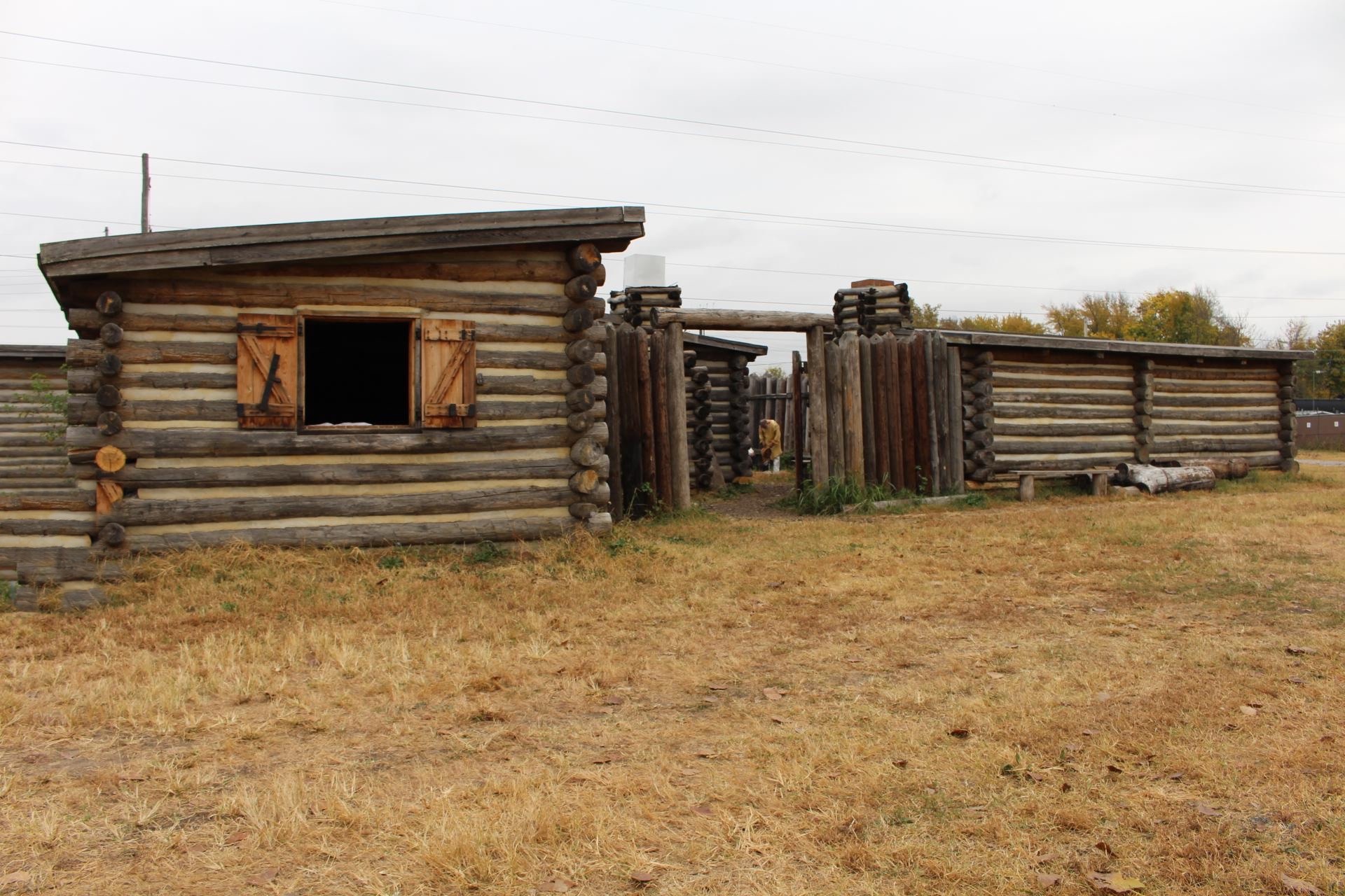
| Wood River |
Our first stop of the day was Wood River, near the confluence of the Missouri and Mississippi Rivers. Experiencing a definite hint of cold weather to come, we shivered on the riverbank as we gazed at the sight Lewis and Clark and their corps saw during the winter of 1803-04 at Camp Wood. (Pictured above: replica of Camp Wood in Illinois)
Because the Mississippi River has shifted, Camp Wood's actual site is uncertain. Today, it may be in Missouri or even under the Mississippi River, but the Lewis and Clark State Historic Site has been built at Hartford, IL, to honor the Corps of Discovery's winter on what was then the Illinois side of the river. The building is now complete but won't open until December.
 |
| Lewis & Clark State Historic Site and Park (Hartford, IL) |
Crossing the mighty Mississippi, we drove to St. Charles, MO, where we got our first good look at the Missouri River in the city's Frontier Park. Like Lewis and Clark, we will be following the Missouri River for a while. Interpretive signs in the park tell about the five days the Corps camped there.
 |
| Missouri River at Frontier Park |
In Frontier Park, we came across a bike path that is part of the Katy Trail State Park, a 150-mile bike/walking path following the former rail corridor and hugging the Missouri River bank, the same forest and bluff country that Lewis and Clark saw in the first three weeks of their expedition.
Interested in visiting the privately owned Lewis and Clark Center in St. Charles, we waited outside the grassroots museum with an increasingly impatient group of 3rd graders, who had come there on a field trip.
 |
| Private museum in St. Charles, MO |
When we returned to the local tourist center and inquired about the center, someone on staff telephoned the museum's owner. By the time we returned to the little museum, the manager had arrived and the children were entering. We quickly realized we would have a long wait and decided to move on.
Along the banks of the Missouri on State Road 94, we visited the Weldon Spring Conservation Area, an 8,400-acre state park. We took a brief walk on the Lewis Trail (but not on the Clark Trail) and drove down to a boat ramp on the Missouri. Since the sun had warmed things up, temps were in the mid-60s by early afternoon.
 |
| Lewis Trail, Weldon Spring Conservation Area |
Driving through central Missouri, we saw lots of farms along the river, even in areas that were quite hilly. We finally found autumn here and began seeing more color in the foliage. In the higher areas along the river, we saw many vineyards. Once the river turned north past Columbia, apples were everywhere, so many orchards that we wondered whether we had arrived in Washington state sooner than expected.
 |
| Arrow Rock State Historic Site |
Characterized as a quiet, serene village, the entire town of Arrow Rock, MO (est. 1829), has been identified as a national historic landmark. Lewis and Clark noted the nearby Arrow Rock, for which the village was named, in their journal. Once a thriving river port, the town is now mostly a historic tourist attraction.
 |
| Arrow Rock village street |
Limestone gutters of carefully carved blocks line the main street like open storm drains. Each time we approached the street from a side road, we had to drive through the equivalent of a stone ditch to reach the highway we needed to leave town. Finally we found an intersection where the gutter was a bit shallower and made our departure. We did notice as we traversed main street that the town had an unusually large number of auto repair shops. Coincidence? We didn't think so.
By the time we arrived at Fort Osage near Sibley, MO, it had closed for the day. Because of its location overlooking the bends and currents of the Missouri, the site was noted by Lewis and Clark as a likely spot for a fort. Four years later, Clark returned to build the outpost, the second constructed in the Louisiana Purchase.
We pushed on to St. Joseph, where we spent the night, having traveled the breadth of the state of Missouri, following the Missouri River and the footsteps of Lewis and Clark.
Miles today: 326
States today: 2 (IL, MO)
space
TUESDAY, 22 OCTOBER 2002
 |
| Old Train Depot, St. Charles, MO |
 |
| Weldon Spring Conservation Area, MO |
 |
| Weldon Spring Conservation Area, MO |